
Google’s new AI could give hurricane forecasters an extra day of warning
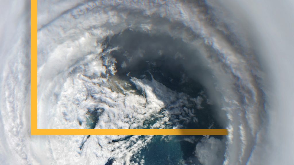
Days before Hurricane Melissa made landfall in Jamaica in October 2025, it was still just a Category 1 storm. But inside the National Hurricane Center, forecasters were watching something unusual. Model after model, including a new artificial intelligence system from Google DeepMind, arrived at the same alarming conclusion: this storm was about to explode into a Category 5 storm.
It was a call the hurricane center had never had the confidence to make this early.
“That’s something we have not historically been able to do with that kind of lead time,” NHC Director Michael Brennan told Straight Arrow. “We didn’t have reliable guidance to forecast rapid intensification more than five years ago, certainly not more than ten years ago.”
As Melissa’s eyewall closed in on Jamaica days later, that early confidence proved warranted. “Take cover now. Catastrophic winds with total structural failure likely near the paths as the eyewall moves across portions of western Jamaica,” Brennan warned, according to an audio transcript. Melissa struck as one of the most intense Atlantic hurricanes on record.
This week, Google published research showing how much further that predictive edge has come and how much extra time it could give people to prepare. But like any forecast, the model isn’t perfect. It’s one tool among many that meteorologists rely on to make the right call.
What’s different about the AI predictive model?
Published in the peer-reviewed journal Nature, Google’s study compared its predictive model, WeatherNext Cyclones, against the leading AI model GenCast, and the traditional model, the Ensemble Prediction System. At the 5-day forecast horizon, WN-C’s average track error was 230 kilometers (143 miles), compared to 370 kilometers (229 miles) for ENS and 335 kilometers (208 miles) for GenCast.
On intensity, its three-day forecast was 3.75 knots more accurate than the Hurricane Analysis and Forecast System, the National Oceanic and Atmospheric Administration’s specialized high-resolution model built specifically for intensity forecasting.
“It’s simply much more accurate than any other piece of track guidance that forecasters currently have — and by a substantial margin,” said James Franklin, a retired branch chief of the NHC’s Hurricane Specialist Unit and a co-author of the study. “It’s got a three-year record of really exceptional performance in track in a way that’s more significant than any other new track model I’ve seen during my career.”
Google’s model also beat traditional models at predicting wind radii, or how far out from the storm’s center damaging winds extend.
Google says its model runs on atmospheric data about 100 times coarser than the specialized high-resolution regional models meteorologists traditionally thought were necessary for accurate intensity forecasting. The paper’s authors said their results challenge the field’s previous assumption that meteorologists need fine-grained data to forecast intensity well and called it an open question they don’t fully understand yet.
New models often perform well during development, when researchers feed them retrospective data, only to underperform once used in real time. WN-C didn’t. Google evaluated the model on 2025 storms specifically because a version of WN-C ran operationally that year.
“I’ve never seen a new model come along and provide this big a jump in accuracy all at once,” Franklin said. “We looked not just at 2025, where it was spectacular, but two years of retrospectives — its performance there was about as good as it was in real time, and that’s unusual in itself.”
Beyond raw accuracy, WN-C provides significantly more “relative economic value” than traditional models — a formal measure of how useful a forecast is for real cost and loss decisions across all tested cost scenarios.
What are the model’s limitations?
WN-C isn’t a finished product. Even by Google’s own measure, the model’s skill at predicting rapid intensification, one of the most dangerous and hardest-to-forecast phenomena in hurricane science, remains limited.
A standard measure balancing correct detections against false alarms and missed events improved from below 0.3 to 0.5 under WN-C. That’s real progress, but also means the model still gets rapid intensification wrong a meaningful amount of time.
When told how Brennan described WN-C as just another input NHC doesn’t solely lean on, Franklin agreed but with a caution.
“[Brennan]’s right, but when you have a model that’s outperforming all the rest over a pretty large sample, you are going to give it more weight than some of the other models,” he said.
Forecasters often start with a consensus of several high-performing models, he explained, then adjust based on where individual models diverge. That means DeepMind’s model can shape a forecast twice: once inside the consensus and again if forecasters “shade” their judgment toward it. Still, Franklin said, “you’re not going to see NHC say, ‘We’re highly confident in DeepMind, we’re taking the forecast to Miami,’ even though everything else says Palm Beach or Jacksonville.”
Google’s own study puts a number on that influence. Once folded into a two-way blend with NHC’s existing consensus models, WN-C received 75% of the weight for the latitude, 89% for longitude and 42% for the intensity. Because that existing consensus is itself an average of five to eight other models, the researchers note WN-C’s effective weight relative to any single traditional model is even larger still.
How could this affect hurricane responses?
Google frames its results in terms of time. The company said WN-C’s three-day forecasts are now about as accurate as two-day forecasts used to be, essentially giving an extra day of warning. For emergency managers, that extra time could be critical.
“If you have as much confidence in the forecast four days out as there used to be three days out, it’ll be easier to support an effective evacuation decision or staging of resources,” Brennan said.
In Louisiana, that timing can matter enormously. The state’s evacuation plan for New Orleans relies on contraflow, reversing highway lanes to speed up mass evacuation. But the process takes roughly 72 hours to execute, including 22 hours just to flip traffic signals and set up barricades, according to the Louisiana Illuminator. Hurricane Ida intensified from a moderate to a catastrophic storm within about 30 hours of landfall, less than half that window.
Bryan Norcross, a Fox Weather hurricane specialist who has served as a paid consultant and tester for the DeepMind project, said the added ensemble scale could reshape how officials plan.
“For the first time, emergency managers will know the odds of a range of threat levels, including low odds but high-impact extreme events,” he said.
Still, Brennan cautioned that “AI modeling for weather forecasting is just another tool in the toolbox.”
“It has the potential to be very valuable, but it is not the only thing we’re looking at,” Brennan said. “There is a human, a very skilled forecaster here … using that expertise to deliver the most consistent, effective forecast, regardless of the inputs that go into it.”
Round out your reading
- Why Gen Z is staying home on the weekends.
- Autism research is entering a new era. Here’s what scientists are learning.
- The big reason small cities want data centers. Hint: It’s not permanent jobs.
- High school teacher arrested at city meeting after clapping for anti-data center speech.
- Off Script: Everyone’s watching Michigan. Our reporter explains why the race just changed.
Ella Rae Greene, Editor In Chief