Satellite mission to ‘weigh’ Earth’s 1.5 trillion trees underway
The European Space Agency has launched its Biomass satellite, a mission designed to enhance the global understanding of how forests affect the Earth’s carbon cycle. The satellite will use advanced radar technology to measure the amount of carbon stored in trees and monitor changes in forest structure, particularly in tropical regions.
What is the Biomass satellite designed to do?
ESA claimed that Biomass is the first satellite equipped with a P-band synthetic aperture radar, the first of its kind in orbit. The radar scans through thick forest cover to estimate tree biomass, focusing on structural elements like trunks and branches. These structures store most of the carbon in forests. The radar’s data will serve as a proxy for estimating carbon storage and help reduce uncertainties in global carbon stock calculations.
Forests absorb about 8 billion tons of carbon dioxide annually, but degradation and clearance of forests release much of this stored carbon. Until now, scientists have lacked precise satellite data to measure these changes, particularly in tropical regions, which are both carbon-rich and hard to access.
Why are tropical forests a focus of the mission?
ESA said tropical forests may account for as much as 75% of global carbon absorption, making them a critical focus for the mission. However, these ecosystems are difficult to monitor due to their dense vegetation and limited access on the ground. ESA officials said the Biomass satellite will help fill that data gap by scanning these forests from space.
According to Simonetta Cheli, director of Earth observation programs at ESA, the mission will also provide insights into how climate change and land use are affecting carbon stocks. By delivering accurate information about forest structure and biomass over time, Biomass will support international efforts to track deforestation and carbon emissions.
“The data collected by Biomass will help us understand how a potential degradation of the forest in the tropical zone can have an impact on the entire evolution of the climate and climate change.”
Simonetta Cheli, ESA’s Director of Earth Observation Programmes
How does the satellite collect and transmit data?
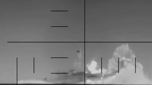
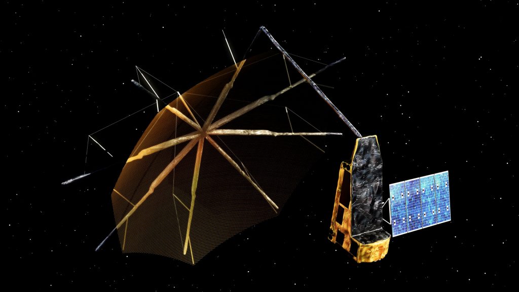
Launched aboard a Vega-C rocket from the European Spaceport in French Guiana on Tuesday, April 29, the Biomass satellite successfully reached orbit and transmitted its first signal within hours. Over the coming days, ESA mission control will oversee the deployment of a 12-meter mesh reflector supported by a 7.5-meter boom. This reflector is essential to receiving radar data from the ground.
The radar operates at a 70 cm wavelength, penetrating even thick forest canopies. The satellite will relay its data to ESA’s control centers, where researchers will process and analyze it. ESA said the mission will operate for at least five years.
What are the broader applications of the mission?
In addition to measuring forest biomass, the radar technology can map subsurface features in deserts, analyze the structure of ice sheets and assess terrain on forest floors. Scientists hope this versatility will extend the mission’s value beyond just forest monitoring.
A consortium of more than 50 companies, led by Airbus UK, built the satellite. ESA described Biomass as part of its Earth Explorer program, which includes missions that address key environmental challenges.
Officials said the data from Biomass will help governments, researchers and policymakers track how forest carbon stocks change over time, aiding in climate models and environmental policy decisions.