
Hurricane Melissa churns toward Jamaica as Category 5 storm
Jamaica is now in the direct path of one of the strongest hurricanes the Caribbean has seen in decades. Hurricane Melissa intensified into a Category 5 storm early Monday morning, and it is projected to hit the island nation early Tuesday.
High surf is already pounding Kingston, with waves crashing over seawalls and flooding streets. People are rushing to stock up on food, board up windows and stack sandbags.
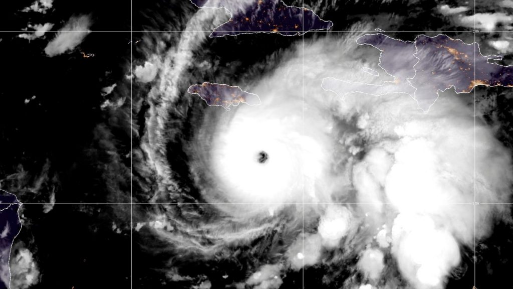
As of 5 a.m. EDT, NOAA satellite images show Melissa’s powerful eye churning about 130 miles south-southwest of Kingston. Winds are now topping 160 miles an hour, and the storm is crawling west at only three miles per hour.

That sluggish pace is what makes it so dangerous. Torrents of rain are dumping on Jamaica, Haiti and the Dominican Republic, with flash flooding and landslides already reported.
As of Monday morning, the storm has killed at least four people: three in Haiti and one in the Dominican Republic.
Future forecast
Melissa is expected to make landfall in Jamaica early Tuesday. It could bring 15 to 30 inches of rain to the area, along with extreme winds, extensive infrastructure damage, and a life-threatening storm surge. The National Weather Service says peak storm surge could reach 9 to 13 feet above ground level.
Some areas could even see up to 40 inches of rain, which is more than some areas of the country typically get in a year, according to NBC News.
The National Weather Service said Melissa could strengthen further on Monday prior to making landfall.
The post Hurricane Melissa churns toward Jamaica as Category 5 storm appeared first on Straight Arrow News.