
How geography and urban sprawl combine to make Texas’ ‘Flash Flood Alley’
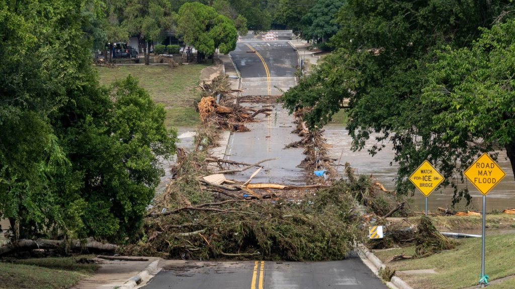
Texas floods are infamous in the collective memory of Americans, and the reasons are more far-reaching than this week’s deadly example. The Hill Country of Central Texas has earned the name Flash Flood Alley due to the prevalence of fast-moving water that can turn deadly during intense downpours.
At least two people died in communities west of San Antonio, Texas, after torrential rain on Thursday. It’s the same region where 130 people were killed — including 25 girls and two counselors at Camp Mystic — due to rising flood waters on July 4, 2025.
-

People search for victims near the Guadalupe River in Kerrville, Texas, the United States, on July 12, 2025. (Photo by Nick Wagner/Xinhua via Getty Images) -

A traffic sign reading “Road may flood” lies on the ground near the Guadalupe River in Hunt, Texas, on July 8, 2025, following severe flash flooding during the July 4 holiday weekend. (Photo by RONALDO SCHEMIDT / AFP) (Photo by RONALDO SCHEMIDT/AFP via Getty Images) -

Debris and damage is seen at a park after a catastrophic flash flood killed more than 100 people and left at least 161 others missing in Kerrville, Texas on July 9, 2025. (Photo by Jorge Salgado/Anadolu via Getty Images)
Texas is, by many metrics, far and away the deadliest state for flooding. According to a study of flood deaths in the U.S. between 1959 and 2019, more than 1,000 people died in Texas during the period, compared with nearly 700 in Louisiana and 340 in California, the second- and third-most deadly states. The study also showed Texas was the only state that consistently reported flood deaths during the six decades studied.
What is Flash Flood Alley?
Flash Flood Alley is a ribbon that unfurls across the middle of Texas, from its northern point, just west of Dallas, down through Austin and San Antonio, before curving west to the U.S.-Mexico border. The Balcones Escarpment — a shelf of limestone rocks on Hill Country’s eastern edge, which raises the elevation by nearly 1,000 feet in some areas — is a key geological driver of the flooding.
Robert Mace, director of the Meadows Center for Water and the Environment at Texas State University, said the warm tropical air from the Gulf Coast washing over Texas contributes to heightened risk.
“When you lift moist air up into the cooler parts of the atmosphere, then you’re far more likely to get a lot of precipitation,” Mace told Straight Arrow. Storms also tend to stall and move slowly across the Hill Country.
Once that precipitation comes, the topography creates the conditions that worsen flooding.
“The soil is thin so it can be saturated very quickly,” Hatim Sharif, a civil engineering professor at the University of Texas at San Antonio, told Straight Arrow.
Most of the water is not absorbed into soil. It charges down the rugged hills through creeks and streams until it flows into more than a dozen rivers in the region. Because of the hilly terrain, the rivers often have narrow banks and the water rises quickly as rain totals add up.
How common are major floods?
Flash flood events occur consistently along the Guadalupe River because of the area’s geography. Shallow river beds, combined with the region’s geology, mean that large rain events raise the river’s water level at a faster rate than average.
The same areas in Texas’ Hill Country currently under evacuation orders were those hit hardest by the flash floods over the July 4th weekend in 2025.
Ten years before that, the Blanco River in nearby Wimberley rose by 40 feet overnight. Thirteen people died and more than 350 homes were destroyed during 2015’s Memorial Day floods. In many parts of Texas, the rain tally exceeded what is needed to be classified as a “100-year flood.”

Mace told Straight Arrow that the concept of a 100-year flood is misunderstood. The 100-year flood has a 1% chance of happening in any given year. Rain events in recent years have dropped increasing amounts of rain on the Hill Country, Mace said, and as the climate changes, flood maps must be updated.
“For the foreseeable future we can expect flooding to get worse,” Mace said.
The expansion of fast-growing urban areas like Austin and San Antonio also raises the chances that flooding will be destructive. Paving over vegetation reduces how much water can be absorbed, increasing runoff into streams and rivers.
What can mitigate the threat?
Some engineering solutions can help: Flood walls divert water, while green infrastructure absorbs it. But preparation and publication education are the keys to preventing floods from turning deadly, experts told Straight Arrow.
“There’s a lot of new people that move into the region that aren’t necessarily as aware,” of the risk, compared with longtime residents, Mace said.
This week’s flooding was even worse in some areas than last years’ July 4th floods. But because that tragic event looms large in recent memory, local officials and the general public were better prepared.
“Hopefully this will continue to be the case,” Sharif said.
Round out your reading
- With more prison space than prisoners, correctional facilities are shutting down.
- ‘Game changer’: New cancer treatment turns major surgery into an outpatient procedure.
- Viewers overwhelmingly support ‘The View’s’ fight against the FCC. Will that matter?
- Why an ICE shooting in Houston isn’t leading to mass protests.
- Milwaukee detective is the latest officer charged with misusing Flock cameras.
Ella Rae Greene, Editor In Chief