Winter storm escalates travel chaos as millions face dangerous conditions
A powerful winter storm is still ripping across large parts of the country on Monday, creating hazardous travel conditions and widespread disruptions from the Midwest to the Northeast. More than 30 million Americans remain under winter weather alerts, as airlines, road crews, and emergency officials warn that impacts will extend into the start of the workweek.
A storm that keeps evolving
The system rapidly intensified over the weekend into what meteorologists call a bomb cyclone. It’s a weather setup fueled by a sharp clash between arctic cold and unusually warm air farther south. The result: heavy snow, blizzard conditions, damaging winds, and rapidly changing forecasts across multiple regions.
According to the National Weather Service, winter storm warnings, blizzard warnings, and advisories stretch from parts of the Upper Midwest through the Great Lakes and into New England. Forecasters say frigid air pushing south will keep conditions volatile even as parts of the storm begin to weaken.

Midwest bracing for the worst
In Minnesota, officials warned that travel could become life-threatening through early Monday, especially in and around the Twin Cities. Whiteout conditions led to crashes and road closures overnight, with blizzard warnings covering much of the state. Forecasters say some areas could see 6 to 12 inches of snow, paired with strong winds that sharply reduce visibility.
Farther east, parts of Michigan’s Upper Peninsula are bracing for more than a foot of snow, with wind gusts strong enough to cause near-zero visibility and potential power outages, according to the NWS.
Flights canceled, airports strained
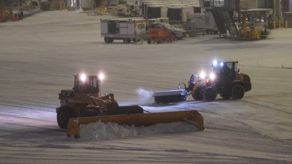
Air travel continues to take a major hit. More than 4,400 flights have been canceled nationwide since Friday, with thousands more delayed, according to FlightAware. Airports from Minneapolis to western New York dealt with brief ground stops, de-icing delays, and snow-covered runways as crews worked to keep operations moving.

In Rochester, New York, heavy snowfall reduced visibility to near zero as planes took off through intense gusts. New York officials declared a state of emergency, citing hazardous travel conditions and the strain on transportation systems.
Snow, ice and wind collide in the Northeast
New York City saw its most significant snowfall in nearly three years, with 4.3 inches recorded in Central Park, according to CBS News. While snowfall totals came in lower than early projections, colder air arriving Monday could turn slush into ice, increasing the risk on roads and sidewalks.

Forecasters warn that parts of New England and upstate New York could see a messy mix of snow, sleet, and freezing rain into Monday, raising concerns about icy travel and scattered power outages.
Severe weather farther south
The same system also unleashed severe weather well south of the snow line. High winds whipped through parts of Kentucky and Illinois, sending debris into highways and prompting tornado warnings Sunday afternoon. In Mount Zion, Illinois, officials reported damage following a suspected tornado.
The post Winter storm escalates travel chaos as millions face dangerous conditions appeared first on Straight Arrow News.